Within the legal framework for port planning in Peru, the National Port Development Plan is the legal and technical instrument used to transfer the public policies related to port management into the port management system. It also ensures alignment with the necessary private initiatives, by both agents and operators as well as individual users of port services. This instrument was approved in 2005 and amended several times. The one currently in force was approved by the Ministry of Transport and Communications in 2012.
In accordance with the aforementioned National Plan, the Regional Port Authorities (RPAs) have a maximum of five years to approve master plans for the regional port terminals under their jurisdiction, and they can sign management agreements with the National Port Authority in order to draft these master plans.
The Lambayeque Regional Port Authority was set up on 11th September 2012. Within the time frames established by the Law, in March 2013 the Lambayeque Regional Government released a call for tenders to develop the Master Plan for the regional port terminal. The tender was awarded to the Lambayeque Port Consortium, comprising Fundación Valenciaport, Acciona Engineering and OIST, S.A.
The objective is to draw up the Master Plan for the Lambayeque Region Port Terminal, defining port infrastructure needs and the port equipment required for the harmonious development of port facilities in the short-, medium- and long-term, identifying physical, economic and strategic potential. These should be consistent with demand forecasts for traffic and services; with the evolution of international trade and transport; with the requirements of the port’s area of influence, including the location of a logistics zone; and with the expected regional and national economic development.
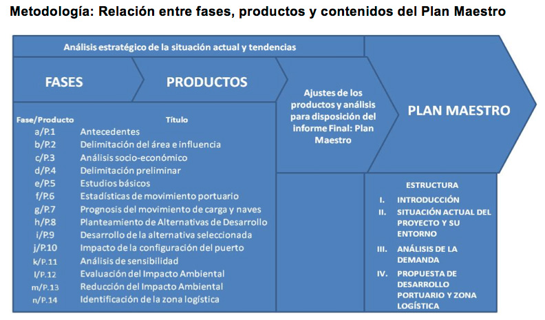
The project was divided into 14 phases / outputs corresponding to the defined structure and contents for the Master Plan, as set out in the National Plan.
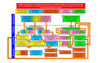
The project was divided into 14 phases / outputs corresponding to the defined structure and contents for the Master Plan, as set out in the National Plan, with the methodology shown in the following diagram.
The following results were achieved:
-
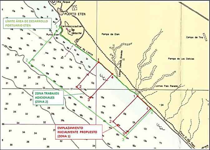
- Site selection for the location of the port facility on the coast of Lambayeque region, using multi-criteria analysis.
- Demand forecast for services relating to cargo and ships, both in terms of existing traffic in the hinterland and its evolution over time, as well as potential traffic, based on an inter-port competitiveness analysis.
- Establishment of an operational model for the facilities.
- Technical, economic and environmental studies to support the different development alternatives proposed.
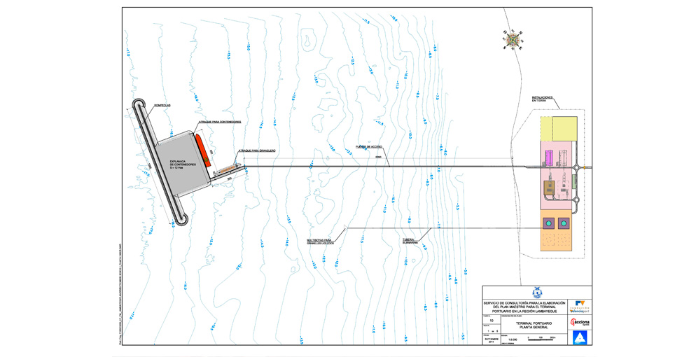
- Definition of the most suitable design and investment options for the new infrastructure, outlining the implementation stages.
- Analysis of accessibility by land and the urban environment.
- Socio-environmental assessment of the potential impacts of the construction works and operation of the terminal. Proposals for community outreach, coordination and agreements reached with the public, in order to establish a suitable framework for fostering relations between the port and neighbouring residents.
- Preliminary study for the location of a logistics zone servicing port activities.
- Implementation of a face-to-face and online training programme for building ties in Lambayeque region’s port community.
Site selection for port terminal location: Zone 2 of the Eten Port Development Area
