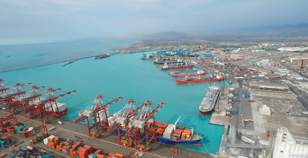
The legal framework of the port system of Peru (SPN by its initials in Spanish) covers the port planning instrument referred to as the National Port Development Plan (PNDP by its initials in Spanish) of Peru. This is approved as a Supreme Decree, and must incorporate the Master Plans or Management Plans for the ports in the system. The current PNDP has been in effect since 2012 and the Master Plan for the Port Terminal of Callao, the main port facility in the country, dates from 2010. Given the time that has elapsed and the fact that concessions have been awarded—including the North Terminal and the Minerals Terminal in 2011—it is considered appropriate to update the Master Plan for the Port Terminal of Callao. That update is the aim of this project.
The studies to be carried out should incorporate a particular focus on:
- Analysis of current traffic, possible new services to be implemented and factors that will shape the future business of the port, considering the corresponding service demand scenarios over a 30-year time horizon.
- Analysis of the compatibility between port development and its urban and environmental surroundings, primarily in regard to impacts on the maritime coastline from beach erosion due to the influence of the port; and
- Analysis of the requirements of the port as an intermodal node, especially with respect to its logistics facilities, functionality and accessibility.
In line with the above, the methodology used to carry out the study is intended to:
- Evaluate the current port situation and trends.
- Study the demand.
- Compare operational capacities (supply/demand balance).
- Study the operational management of different types of traffic.
- Define foreseeable needs.
- Define objectives and strategies.
- Select, evaluate and determine the most appropriate alternatives in the time planning scenario.
- Draw up the functional design of the new configurations.
- Establish the basic elements of the operational model (infrastructure, equipment, facilities and services).
- Evaluate and schedule investments.
- Consider corresponding environmental issues.
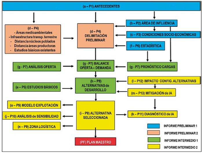
The methodology of the consultancy entails 5 Stages that can be broken down into 15 phases, from (a) to (o). An additional phase, Phase 0, involves producing the Work Plan. These phases yield 13 outputs, the contents of which combine to form the final Master Plan document.
Geographically, the area of influence (hinterland) of the Port Terminal of Callao (TPC in Spanish) is comprised of six regions: Callao, Lima, Junín, Ica, Ancash and La Libertad, which together cover an area of around 160,000 km2
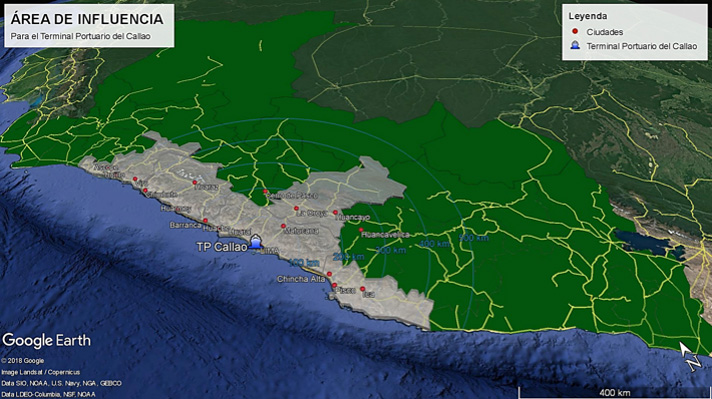
PRELIMINARY DELINEATION
In accordance with the PNDP, the areas of port development must adhere to the stipulations of the Law of the National Port System (LSPN by its initials in Spanish). Thus, for the case of the Port of Callao, the following areas of port development have been identified for the Callao area:
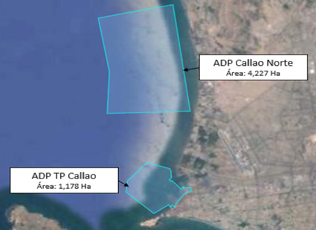
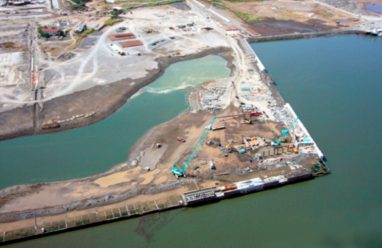
Regarding potential in the current location of the port, the proposal for expanding the facilities covers three areas: the potential expansion of the South Container Terminal, the concession for which has been awarded to DP World Callao; the expansion and restructuring of the Multipurpose North Terminal, with the concession awarded to APM Terminals; and an area of new development based on Phase VI of the 2010 Master Plan. This proposal includes the design of new breakwaters.

